Select an edition to view:

Trans-Atlantic Crossings and the Tools Available to You
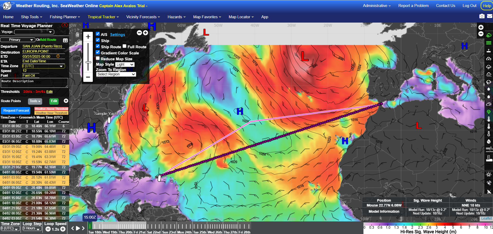
Alex Avalos, Operations Manager It is almost that time of year again. As the winter comes to a close, many vessels will be embarking on Trans-Atlantic passages back to Europe for the start of their summer charter seasons. Challenges can arise from such passages, as strong ridging across the Atlantic can expose vessels to strong trade winds on the nose. As the gale and cold front tracks begin to shift further north headed into the spring, further adversities can present themselves in finding the most favorable route. Another concern that arises is the presence of cutoff gales, and given their tendencies to be further south than their non-cutoff counterparts, creative routing may need to be considered to further avoid enhanced head conditions. This is where we come in. Our team of dedicated and experienced Meteorologists are ready to work with you to help you get across the pond, safely and comfortably. We offer you a number of tools to assist with your endeavor: - Customized forecasting and route recommendations - Discounted trans-ocean forecast packages - Weather window planners - Heavy weather alerts and tropical surveillance for your current and expected location - Climatology studies
We at WRI look forward to assisting you with your next Trans-Atlantic voyage. Please give us a call at +1 518-798-1110, or email us at wri@wriwx.com, and our team of Meteorologists, who are available 24/7, will be happy to discuss our forecasting services and how we can make upcoming passages you have, as smooth as possible. |

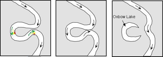
The Challenges of Cut-off Lows
Cara Czech, Meteorologist As we jump into the start of spring, many vessels begin to plan their trans-Atlantic voyage to the Mediterranean during this time of year, though planning can become increasingly more challenging depending on the weather pattern. A cut-off low is an surface-level low pressure system that becomes separated from a fast-moving air river current called the Jet Stream. This weather feature often poses challenges in predicting its strength and track, especially in the long term.
WRI monitors vessels that are underway on a daily basis, ensuring our full efforts in keeping our clients well informed and up to date on systems like cut-off lows that may impact their voyage. Contact WRI to schedule a customized forecast for your next trip. |
|
Weather Routing to Present Webinar for Sailing and Boating, LLC.
Alex Avalos, Operations Manager On Thursday evening, April 03rd from 06:30pm EDT, Operations Manager and Senior Meteorologist Alex Avalos will be presenting a webinar for Sailing and Boating, LLC, which will be hosted by Deb and Hugh Marlor. The first part of the discussion will entail a discussion on weather basics for boaters, including, but not limited to the drivers of weather, and the tools you can use to create a self weather briefing. The second part of the discussion will entail how you can use these tools to recognize changing weather patterns through cloud behavior, the steps you can use to prepare yourself for offshore passages and the tools available to you for monitoring the weather. This webinar is open to the public, and you can sign up for the webinar here: We look forward to seeing you there!
|

| Upcoming Events | ||||
|
| Product/Services | ||||||||
|
||||||||
| NEW SeaWeather App | ||||||||
|