Select an edition to view:


WRI Mediterranean Charter and Cruise Forecasts
David Cannon, Director of Operations Do your plans take you to the Mediterranean for local cruising or chartering this summer? WRI has the services to fit your needs and keep you safe and informed in what can be a rather changeable and active area weather-wise. Our customized forecast services include forecasts for local vicinities, as well as for those doing short, "local" cruises across the region. As a special benefit, we at WRI offer prepaid Charter Forecast Packages at various discounts, to provide you with the information you need, and as competitive, cost-effective solutions. Maps showing your vessel's dead reckoned position and overlays of winds and seas are offered as well to those interested ... ... and don't forget, those who utilize our customized routing and forecast services can take advantage of our complimentary instant severe weather alerts while actively onboard and using our services and for a two-week period after. These include alerts on Mistrals, Etesians, Boras, Levantes, and Marins/Ostros. These are offered on a longer-term basis to those who subscribe to our SeaWeather supplemental online weather information service, and special weather statements are included for such things as widespread squall clusters. Lightning data is now included on SeaWeather as well. Whereever your travels take you, we look forward to hearing from and are available any time to assist. |

WRI and CB Rows
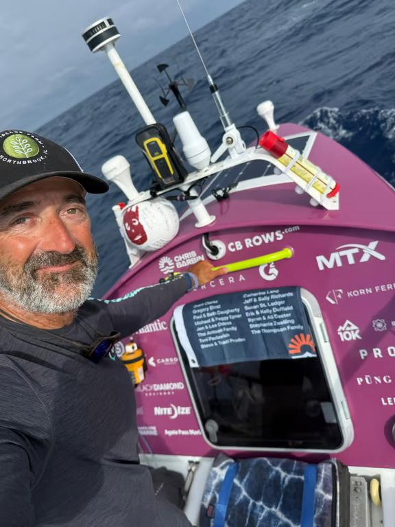
Brian Whitley, Operations Manager During the wee hours of March 27th 2026, Chris Barbin pushed off the dock of Blue Water Cove Marina in Monterrey CA. Instead of using a motor or sail, he was under his OWN power for a long (1500nm) row a custom-made rowboat “Moderation”, down the California and Baja Peninsula coasts to Punta Mita (near Puerto Vallarta) Mexico. This was not just a way for him to test himself, but to raise awareness surrounding mental health challenges and substance abuse for young men and their families. Chris’s story was a deeply personal one that involved his own son’s personal difficulties. His aim was to not only to point out how he had missed the signs of his son’s addiction, but to help other parents by raising both awareness and money for Project Healthy Minds and Providence Farm, the services that ultimately helped his son make a recovery. WRI has previously helped rowers with long crossings such as this and we became involved with the project back in April of 2025 when Tez Steinberg (serving as the project GM and shore-based support), reached out to us to see if we could help. Tez himself is a veteran of long oceanic rows himself, having completed solo rows from California to Hawaii and then onward to Australia! WRI produced a pair of climatology reports, initially for a route through the Gulf of California and then starting in S’rn California and staying west of the Baja. Ultimately, it was decided to be best to start the transit from Monterrey in late March/April for the best possible conditions. This significantly increased the originally planned distance, from around 900nm for inside the Gulf of California, to the 1500nm transit he has since completed.
Chris Barbin aboard "Moderation". 'Wilson' (over his left shoulder) was his lone companion and was NOT allowed to assist with the rowing. While the weather along the Baja itself tends to be relatively straightforward in March/April, that is not always the case for S’rn California, so it was important for Chris/Tez and WRI to find a good window to start and Mother Nature was cooperative allowing for a good window to start heading south on that late March day. During the transit, WRI was providing updates along the way recommending routes that aimed to minimize any concerns with the overall weather for Chris while also maximizing any current assistance he could get, without adding much distance in the process. WRI worked closely with Chris and Tez through out the voyage. 1529.95nm and 38 days, 00 hours, and 10 minutes later, Chris triumphantly arrived into Punta Mita! "WRI's support was invaluable to the CB Rows expedition success. WRI's detailed forecasts and meteorgrams, plus around-the-clock responsiveness were huge. Most of all, I was grateful to collaborate with your team as Chris approached Cabo to modify his routing plan in a way that I would never have attempted on my own without your professional support." -Tez Steinberg, Project GM for CB Rows
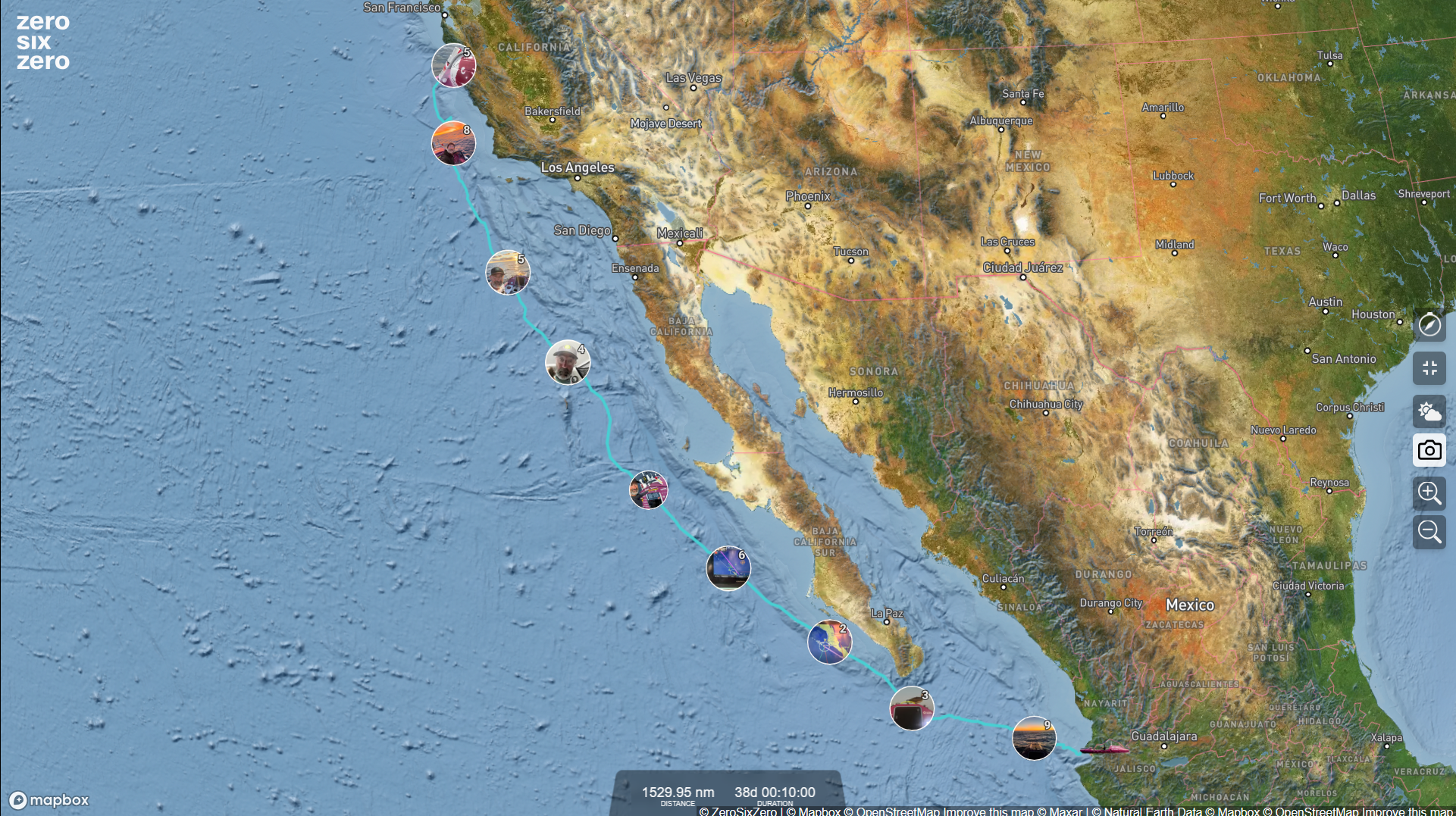
The above image was taken from the tracker on Chris's page (https://cbrows.com/) Chris had set a goal of raising $750,000 for Project Healthy Minds and Providence Farm and so far he’s managed to raise over $545,000, which no doubt will be a greatly welcomed gift for the two organizations and the people they are helping. To read more about Chris’s story, you can visit his website and if you’d like to donate to his cause you can do so here. |
| Upcoming Events | |||
|
| Product/Services | ||||||||
|
||||||||
| NEW SeaWeather App | ||||||||
|