Cruise Surveillance
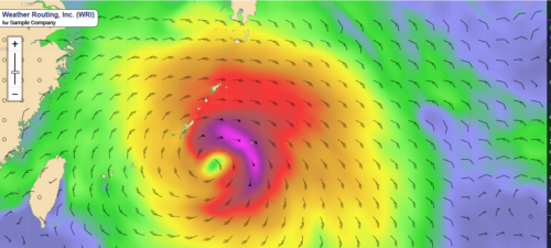
Weather Routing Inc. (WRI) has developed a system designed specifically for safe and enjoyable cruise transits. Our team continuously monitors your vessels for any potential tropical or adverse weather threat, and your operations team and vessels are immediately alerted so that preparations can be made. WRI can commence our optimum routing/forecasting to safely avoid or minimize the threat. With our team constantly watching over your fleet, you can rest assured that your vessels will be in good hands.
Weather Routing Inc. (WRI) has developed a system designed specifically for safe and enjoyable cruise transits. Our team continuously monitors your vessels for any potential tropical or adverse weather threat, and your operations team and vessels are immediately alerted so that preparations can be made. WRI can commence our optimum routing/forecasting to safely avoid or minimize the threat. With our team constantly watching over your fleet, you can rest assured that your vessels will be in good hands.
- Continuous monitoring for any threat
- Customized “heavy weather” thresholds
- Daily Tropical Summaries and storm-specific alerts
- Daily Adverse Weather Summaries
- Daily Port Summaries and Trip Summaries
- Daily Port Forecasts and Forecast Maps
- Upgrade to Optimum Routing/Forecasting
- 24/7 access to our Dolphin website
Optimum Routing/Forecasts
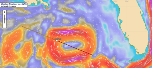
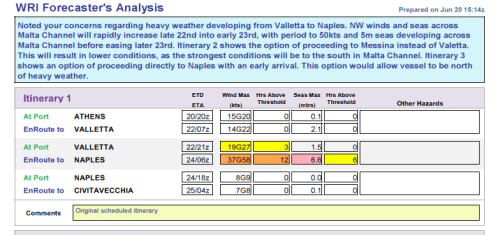
WRI’s marine meteorologists provide suggested routing and forecast conditions along each route to ensure a safe and enjoyable transit. Updates are provided often as required, with our team continuously monitoring for the best route given your requirements.
WRI’s marine meteorologists provide suggested routing and forecast conditions along each route to ensure a safe and enjoyable transit. Updates are provided often as required, with our team continuously monitoring for the best route given your requirements.
- Pre-Voyage Reportsfor initial route planning
- Optimum route recommendation
- 6-hourly tabular forecasts
- Synoptic weather discussion
- Forecast maps/charts
- Comparison route options/forecasts
- 24/7 access to our Dolphin website
 Loading...
Port Forecasts
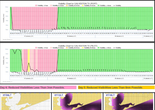
Every port stay is an important part of the cruise for your guests. Our detailed Port Forecasts/Reports provide your operations team with critical weather forecasts both at the berth and the seabuoy covering the next four days. Forecasts are sent for your next two port calls for advanced planning. All port-related forecasts can be generated on our Dolphin website at any time.
Every port stay is an important part of the cruise for your guests. Our detailed Port Forecasts/Reports provide your operations team with critical weather forecasts both at the berth and the seabuoy covering the next four days. Forecasts are sent for your next two port calls for advanced planning. All port-related forecasts can be generated on our Dolphin website at any time.
- Four-day outlook covering next two ports of call
- Forecast conditions at berth and seabuoy
- Detailed Tender Reports for sensitive port calls
- Detailed Visibility Reports in poor visibility-prone regions
- Reports created on-demand on Dolphin
Dolphin Online
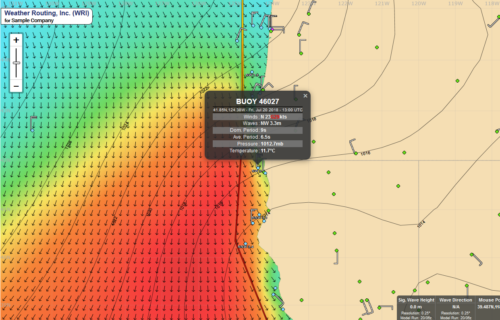
WRI’s Dolphin website (wriDolphin.com) is your one-stop-shop for weather information for your fleet. Forecast Maps, Tropical Tracker, Voyage Planner, and Fleet Monitoring Dashboard are just a few of the valuable tools included on Dolphin to ensure your vessels are safe/informed and that your operations team is effectively managing your fleet.
View Our Fleet Monitoring Dashboard Brochure
WRI’s Dolphin website (wriDolphin.com) is your one-stop-shop for weather information for your fleet. Forecast Maps, Tropical Tracker, Voyage Planner, and Fleet Monitoring Dashboard are just a few of the valuable tools included on Dolphin to ensure your vessels are safe/informed and that your operations team is effectively managing your fleet.
-
- Interactive web-based software to monitor weather
- Latest data-continuously updated with no hardware required
- Fleet dead-reckoned on all forecast charts
- Winds, Seas, Precipitation, Currents, Temperatures, Visibility, Ice, and more
- Port Forecasts and specialized reports for any location
- Fleet Monitoring Dashboard for all weather/performance data
- Tropical Tracker provides latest tropical analysis, forecasts, and discussions
- Voyage Planner compares various routing options for safe/efficient transits
- Real-time observations (ship, land, buoy), satellites, and radars
- AIS satellite tracking/polling
View Our Fleet Monitoring Dashboard Brochure
Dolphin OnBoard
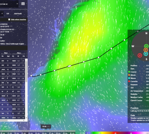
WRI’s Dolphin OnBoard is the “desktop” version of our Voyage Planner, which allows the user to evaluate multiple routing options and overlay weather/current charts to assist in planning the optimum transit. When used in conjunction with our Optimum Routing/Forecasting services, your vessels will have the tools required to prosecute a safe and efficient voyage.
Contact WRI and we can arrange a demo and instructions to download the software from WRI Dolphin website.
WRI’s Dolphin OnBoard is the “desktop” version of our Voyage Planner, which allows the user to evaluate multiple routing options and overlay weather/current charts to assist in planning the optimum transit. When used in conjunction with our Optimum Routing/Forecasting services, your vessels will have the tools required to prosecute a safe and efficient voyage.
- Desktop software downloaded to any computer
- Continuous Internet connection is not required
- Route/Weather data packages emailed four times daily
- View/edit route/speed options
- Overlay forecast maps and real-time data
- Vessel dead-reckoned on all routing options out to 10 days
- Compare time, distance, weather, currents, and more
- Summary table guides user to the optimum route
Contact WRI and we can arrange a demo and instructions to download the software from WRI Dolphin website.
Specialized Products/Services
WRI provides many additional specialized products and services that can assist with the planning, execution, or analysis of any transit.
WRI provides many additional specialized products and services that can assist with the planning, execution, or analysis of any transit.
- Climate Reports for route/voyage planning
- CrEWS elevated wind data
- Multiple Itinerary Matrix
- Earthquake/Tsunami alerts
- Piracy alerts
- Icebergs, Sea Ice, Freezing Spray
- Legal/Forensic analysis and review
Meteorological/Oceanographic Data
WRI maintains a continuous high-speed flow of weather data consisting of a wide variety of both forecasting and observational data. We receive World Meteorological (WMO) authorized data, plus data from government and non-government sources. The data is used not only for forecasting, but also in any required analysis of the transit. We can also supply data for our clients’ in-house systems for their own internal use.
WRI maintains a continuous high-speed flow of weather data consisting of a wide variety of both forecasting and observational data. We receive World Meteorological (WMO) authorized data, plus data from government and non-government sources. The data is used not only for forecasting, but also in any required analysis of the transit. We can also supply data for our clients’ in-house systems for their own internal use.
Brochures
Please view the below links for additional details on our products/services for cruise fleets.
Please view the below links for additional details on our products/services for cruise fleets.


